
Hurricane Sandy's barreling west on Monday, with the worst of the storm expected to reach cities like Washington, D.C., and New York City later in the day and into Tuesday, with some storm surge levels and rainfall amounts higher than they've ever been in some areas.
Sustained winds are expected to exceed 90 mph, and Sandy's expected to strengthen and turn into a winter storm system once it makes landfall, dropping up to 2 feet of snow in parts of West Virginia, Ohio, and Pennsylvania.
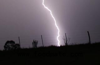
"While living in the here and now, it is sometimes difficult to grasp the historic event that is unfolding with Hurricane Sandy. Sandy will be associated with infamous names like Andrew, Camille, Hugo, and Katrina," according to a report from the Iowa Environmental Mesonet on Monday morning. "The featured image displays a visual comparison of forecasts from the National Hurricane Center and the track of Sandy up until this morning. The track does not tell the whole story of the size and impacts from this storm system that are being felt from Maine to Florida and to the west even to Chicago!"
Will Sandy bring soil moisture recharge?
Hurricane Sandy represents the polar opposite of what most U.S. farmers have faced this year in the drought that's devastated crop potential. But will the moisture the storm is bringing ashore be enough to help ease the chances of drought continuing into next year? That's a tough guess to make right now, says Iowa State University ag meteorologist Elwynn Taylor. Certainly the eastern reaches of the Corn Belt will get as much as 4 inches of rain, but will it be enough?
"Ohio was expected to get recharge anyway. From west of Indianapolis on, that's where we have a concern," he says. "But, we are in a situation that's really hard to evaluate."
The reason it's so hard to evaluate, he says, is because the drought that many saw as starting this past spring has actually been in play since July 2011. That means there are now two types of moisture shortages: Hydrological (regarding surface water) and agricultural (water in the soil). And for hydrological drought to clear up, it's going to take the agricultural drought to end first.
"Until the soil is filled up with water, you don't get a good sustained seep into wells, ponds, and streams," Taylor says. "Instead of 8 inches to correct the situation, we'll need 16-18 inches of rain to soak in. We normally don't get that over the winter."