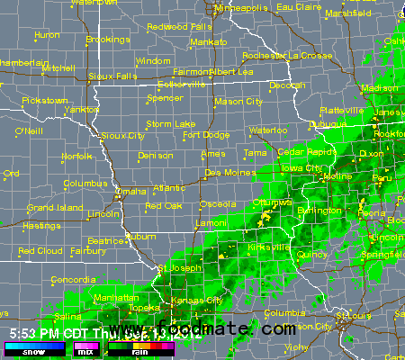
Much of the hard-red winter wheat belt of the southern Plains is forecast to see rains of over a half inch in the near-term, with the potential for bigger rains of over an inch for central through southwestern Oklahoma through a large part of Texas. The areas favored (disfavored) for rains in the near-term are likely the areas to be disfavored (favored) for rains next week. We will see a series of re-enforcing shots of cool air arrive in the Nation's midsection next week, each of which will bring with them a fresh rainfall threat.
Those systems will not be able to pick up much moisture though until they reach the Mississippi River and points eastward, so that is the area that is favored for rains (with the western Corn Belt and Plains looks looking at limited totals). Heat yesterday in the Plains and western Corn Belt was quite notable (lots of 90s for highs; record highs scored at Sioux City and Sioux Falls as readings for both places topped the 95 degree mark), but it is below normal temperatures that will be most notable for the second half of September.
Things look to be getting especially cold for Monday of next week and beyond. I think that this pattern means that it is just a matter of time before we see a frost/freeze in a significant part of the Midwest. Already this Friday morning there will be a lot of 30s for lows in northern Iowa and points northward and some isolated places will be in the 32-35 degree range.
Tuesday and Wednesday mornings of next week is another cold period, and I think that some isolated locations then will get to 32 or a little lower. Additional threats of sub-freezing temperatures appear to be almost a certainty for later in the month as well. This cold should have no impact on the corn crop and likely a minimal impact on the soybean crop given the advanced state of maturity of this year's crops.


